

par Rocky Shore Gold Ltd. (CVE:RSG)
Rocky Shore Drills 15.0 metres of 2.04 g/t Au Including 5.0 metres of 3.85 g/t Au, Announces Discovery of the Lucky 13 Gold Zone
TORONTO, ON / ACCESS Newswire / August 5, 2026 / Rocky Shore Gold Ltd. ("Rocky Shore" or the "Company") (CSE:RSG)(OTCQB:RSGLF) is pleased to announce the discovery of gold mineralization at the Lucky 13 Gold Zone identified during the Company's ongoing inaugural diamond drill program at the Lane Pond Gold Target, part of its 100%-owned Gold Anchor Project in central Newfoundland (see Map 1 below).
To date, the Lucky 13 Gold Zone has been intersected in numerous widely spaced drill holes along a potential strike length of 1,800 metres, a dip extent of up to more than 500 metres and ranges between 6.38 metres and 17.02 metres thick (interpreted to be approximately true thickness). The zone remains open in all directions and is observed to have increasing gold grades at depth, based on drill results to date.
To date, a total of 25 holes, comprising 8,086 metres have been completed, with samples from 15 holes, comprising 4,866 metres assayed and reported (see Map 2 below). Three holes (LP-26-01, 02 and 07) were reported in a news release dated June 10, 2026. Results from the remaining holes will be released when available. The Lucky 13 Gold Zone results are highlighted below (see Table 1 for full results).
15.02 metres grading 2.04 g/t Au, including 5.00 metres grading 3.85 g/t Au (LP-26-13)
17.02 metres grading 0.65 g/t Au, including 8.70 metres grading 1.02 g/t Au (LP-26-07)
13.00 metres grading 0.71 g/t Au, including 4.00 metres grading 1.37 g/t Au (LP-26-12)
14.40 metres grading 0.60 g/t Au, including 6.10 metres grading 1.00 g/t Au (LP-26-19)
8.11 metres grading 0.84 g/t Au, including 5.03 metres grading 1.10 g/t Au (LP-26-02)
14.91 metres grading 0.44 g/t Au, including 3.99 metres grading 1.10 g/t Au (LP-26-01)
Key Highlights
Discovery of the Lucky 13 Gold Zone, interpreted as an orogenic hydrothermal gold system is associated within the Appleton Fault Corridor associated with an 11.0-kilometre-long geophysical anomaly termed the Lane Pond Gold Target. Only 15% of the Lane Pond Gold Target has been tested with shallow drill holes.
Drill hole LP-26-13 represents the highest-grade (15.02 m grading 2.04 g/t Au) and deepest gold intersection (~300 metres vertical - see Map 3 below). Drilling at depth intersected a more intensely brittle-deformed interval characterized by stronger quartz veining, stockwork development, increased silicification, and substantially higher gold grades than holes drilled near surface.
A progressive change caused by structural upgrading within the Lucky 13 Gold Zone, from predominantly ductile to a brittle overprinting at depth, was observed in drill holes LP-26-12 and 13.
The Lane Pond Gold Target now supports an emerging model in which localized structural reactivation and upgrading exists within a broad, orogenic, fertile, extensive hydrothermal corridor which may preferentially host higher-grade gold mineralization.
Ken Lapierre, President and CEO of Rocky Shore Gold, commented, "The Lane Pond Gold Target now hosts the Lucky 13 Gold Zone, an extensive hydrothermal gold-bearing system associated with the Appleton Fault Corridor. The Appleton Fault Corridor trends across the entire Gold Anchor Project for over 60 kilometres based on current geological interpretation. This corridor could provide an important conduit to transport and deposit multiple gold discoveries throughout the Gold Anchor Project. These initial drill observations provide the first real evidence that localized structural reactivation and upgrading exists within the corridor and that the discovery of similar geological settings elsewhere across the 11-kilometre-long Lane Pond Gold Target and within Gold Anchor is excellent."
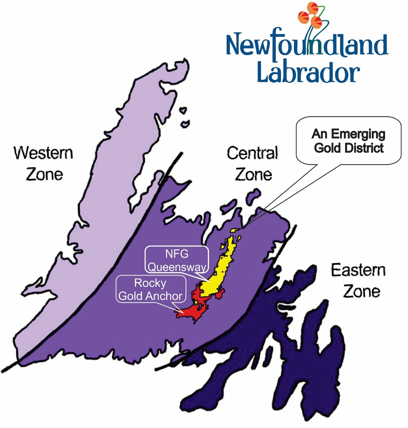
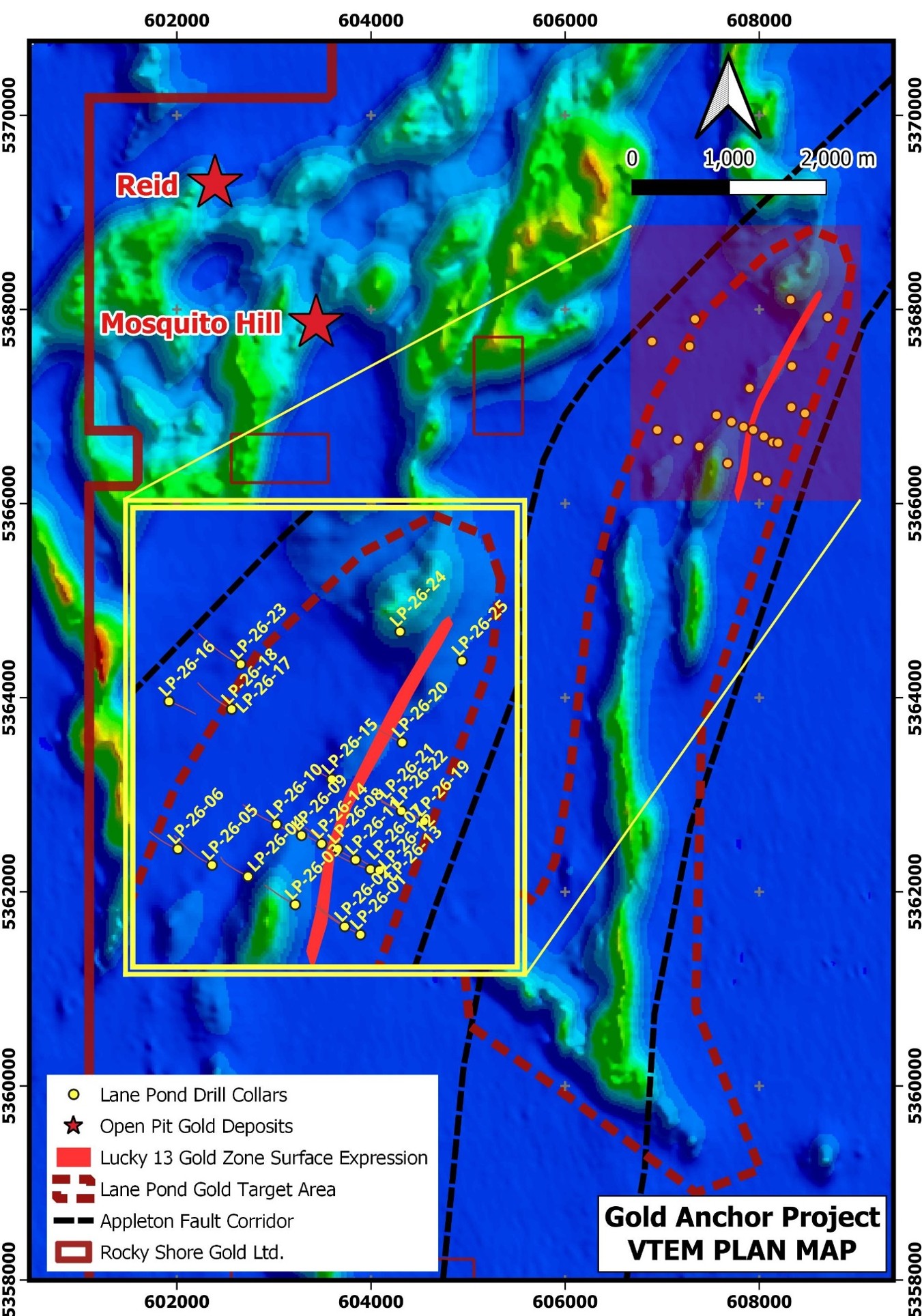
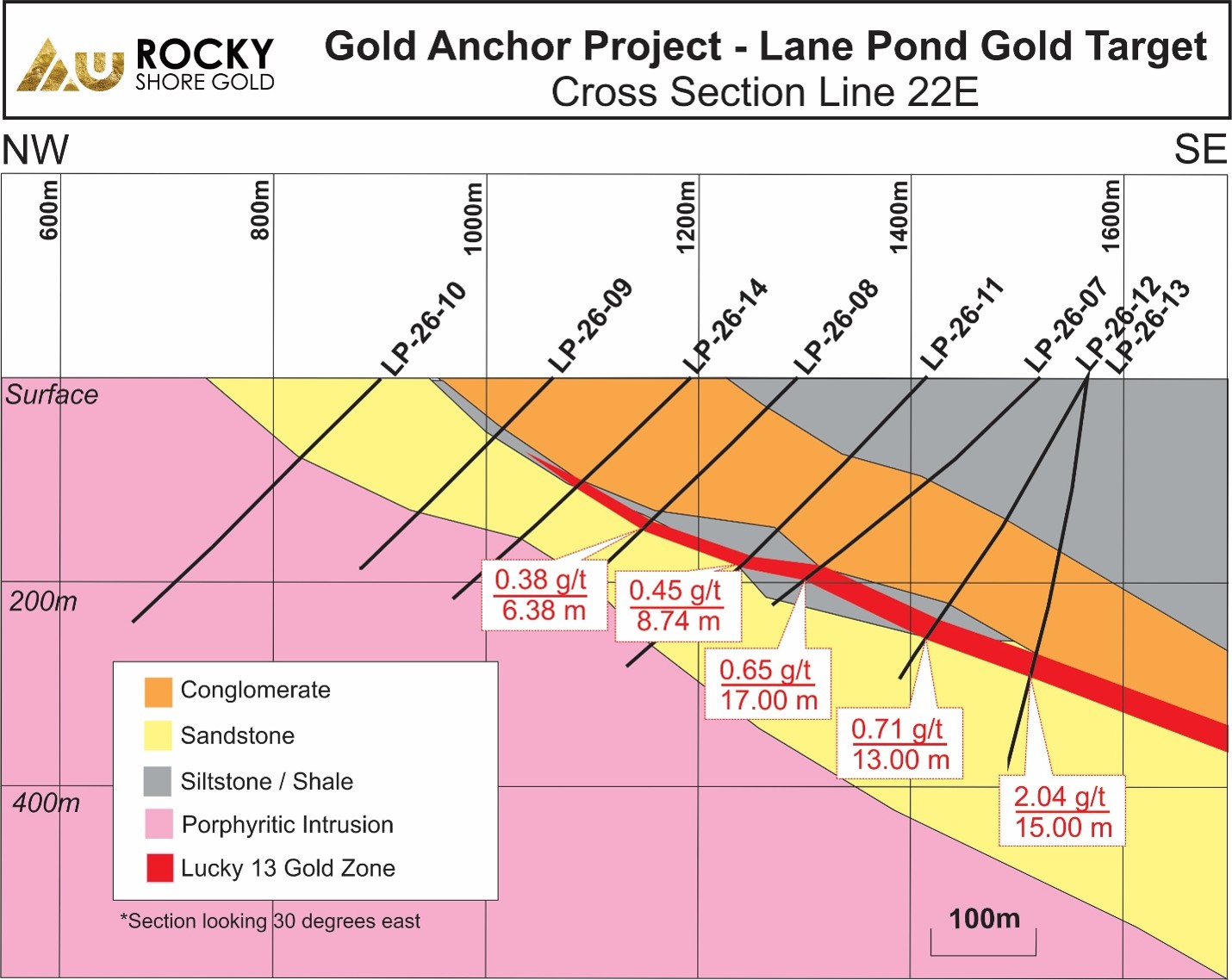
Table 1: Drill Assay Summary Table - the length below is estimated to be approximately true thickness.
Drill Hole* | From (m) | To (m) | Length (m) | Au g/t | Comment |
LP-26-01 | 284.24 | 297.50 | 13.26 | 0.41 | Mineralized Zone |
and | 324.25 | 339.16 | 14.91 | 0.44 | Lucky 13 Gold Zone |
including | 335.17 | 339.16 | 3.99 | 1.10 | |
LP-26-02 | 270.37 | 278.48 | 8.11 | 0.84 | Lucky 13 Gold Zone |
including | 271.37 | 276.40 | 5.03 | 1.10 | |
LP-26-07 | 280.60 | 297.62 | 17.02 | 0.65 | Lucky 13 Gold Zone |
including | 288.92 | 297.62 | 8.70 | 1.02 | |
including | 292.00 | 296.35 | 4.35 | 1.41 | |
LP-26-08 | 196,00 | 202.38 | 6.38 | 0.38 | Lucky 13 Gold Zone |
LP-26-11 | 243.00 | 251.74 | 8.74 | 0.45 | Lucky 13 Gold Zone |
LP-26-12 | 231.00 | 236.00 | 5.00 | 0.82 | Mineralized Zone |
and | 285.00 | 298.00 | 13.00 | 0.71 | Lucky 13 Gold Zone |
including | 292.00 | 296.00 | 4.00 | 1.37 | |
LP-26-13 | 186.86 | 192.45 | 5.59 | 0.40 | Mineralized Zone |
and | 215.00 | 221.15 | 6.15 | 0.58 | Mineralized Zone |
and | 275.98 | 291.00 | 15.02 | 2.04 | Lucky 13 Gold Zone |
including | 283.00 | 288.00 | 5.00 | 3.85 | |
including | 284.00 | 285.00 | 1.00 | 5.70 | |
LP-26-19 | 318.40 | 332.80 | 14.40 | 0.59 | Lucky 13 Gold Zone |
including | 318.40 | 324.50 | 6.10 | 1.00 |
*Holes 3, 4, 9, 15-18 reported no significant assay results targeting undrilled geophysical anomalies. Holes 5, 6, 10, 14, 20-25 assays are pending. Hole 21 was abandoned due to caving and did not reach the intended target.
Table 2: Drill Plan Summary Table
Drill Hole | Easting | Northing | Dip | Azimuth | Length (m) |
LP-26-01 | 608077 | 5366228 | -45 | 295 | 439 |
LP-26-02 | 607980 | 5366278 | -45 | 295 | 319 |
LP-26-03 | 607674 | 5366414 | -45 | 295 | 307 |
LP-26-04 | 607382 | 5366588 | -45 | 295 | 271 |
LP-26-05 | 607160 | 5366658 | -45 | 295 | 379 |
LP-26-06 | 606949 | 5366758 | -45 | 295 | 271 |
LP-26-07 | 608139 | 5366632 | -45 | 295 | 340 |
LP-26-08 | 607937 | 5366759 | -45 | 295 | 331 |
LP-26-09 | 607713 | 5366842 | -45 | 295 | 262 |
LP-26-10 | 607559 | 5366910 | -45 | 295 | 334 |
LP-26-11 | 608047 | 5366691 | -45 | 295 | 409 |
LP-26-12 | 608194 | 5366626 | -60 | 295 | 349 |
LP-26-13 | 608194 | 5366626 | -82 | 295 | 379 |
LP-26-14 | 607837 | 5366797 | -45 | 295 | 316 |
LP-26-15 | 607900 |